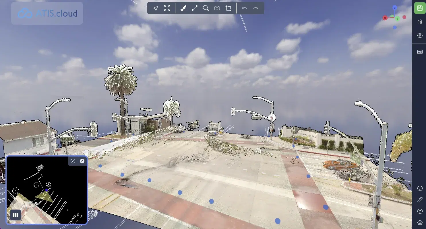
View your 3D point clouds onlineno install needed
Explore your 3D scans up to 500 GB directly in your browser. Share them easily with your clients and collaborators.
No credit card required · No commitment
500 GB
Max file size
0
Installation required
8
Compatible scanner brands
What is a 3D point cloud?
A point cloud is a set of millions of 3D coordinates (X, Y, Z) captured by a laser scanner or drone. Together, these points form an accurate reproduction of a building, terrain, or infrastructure.
Surveyors, architects, and engineers use them to document existing conditions, monitor construction, or compare as-built to BIM models.
The problem?
These files weigh 10 to 500 GB and require heavy software (ReCap, Cyclone...) to open.
ATIS.cloud solves this: view, measure, and share directly in your browser, nothing to install.
Laser scanner or drone
Captures reality in millions of points
3D file (E57, LAS, LAZ...)
10 to 500 GB of data
ATIS.cloud
View in your browser
Why surveyors and BIM managers choose ATIS.cloud
High-performance visualization
Navigate point clouds up to 500 GB directly in your browser, including on tablets. Our streaming technology progressively loads data, no dedicated GPU or workstation required.
Works with all scanners
FARO, Leica, Trimble, Riegl, NavVis, Viametris, Matterport, GeoSLAM. Import your files regardless of your scanner. ATIS.cloud is 100% agnostic.
Measure & annotate on the scan
Take measurements directly on your point cloud. Add annotations to communicate with your teams and clients without leaving the browser.
Simple and instant sharing
Send a link to your clients. They view the 3D scan in their browser, without creating an account or downloading any software.
BIM / model comparison
Overlay your IFC model with your point cloud to detect deviations between design and as-built. Available with the Advance plan.
Data sovereignty in 22+ countries
Your data is hosted as close to you as possible, in 22+ countries. SSL/TLS encryption on all communications. GDPR / CCPA compliance guaranteed.
How to view your point clouds in 3 steps
Create your account
Sign up in seconds and access your project workspace.
Upload your point cloud
Drag and drop your E57, LAS, LAZ, RCS, RCP or other supported format file. Files up to 500 GB accepted.
Share with your clients
Your clients and collaborators view the scan without installing anything.
All supported point cloud formats
ATIS.cloud imports files from all scanners on the market. No conversion needed.
| Format | Extension | Plan required |
|---|---|---|
| E57 | .e57 | Standard |
| LAS | .las | Standard |
| LAZ | .laz | Standard |
| RCS | .rcs | Advance |
| RCP | .rcp | Advance |
| LGSx | .lgsx | Advance |
ATIS.cloud vs the alternatives
Compare ATIS.cloud to traditional desktop solutions and other cloud platforms.
| Feature | Desktop software (ReCap, Cyclone...) | Other platforms | ATIS.cloud |
|---|---|---|---|
| Installation required | Yes (heavy software) | ||
| Pricing | On request | Varies | Request a quote |
| Share with clients | Limited | Yes | |
| All scanners compatible | Proprietary | Partial | Yes (agnostic) |
| Measure & annotate | Basic | Yes | |
| BIM comparison | With plugins | Rare | Yes (Advance) |
| Data sovereignty (22+ countries) / GDPR / CCPA | Varies | Yes |
Who uses point cloud visualization?
Surveyors
View your field surveys directly in the browser. Check scan coverage and quality before delivering to the client, without opening Cyclone or ReCap.
BIM Managers and designers
Access the reference point cloud during modeling. Share the 3D app with the project team to validate design decisions based on real-world data.
Facility managers
Archive and access 3D surveys of your buildings. Give maintenance teams access without specialized software.
For every industry
Discover how ATIS.cloud adapts to your sector.
Surveyors
Deliver your scans to your clients in seconds. They view without installing anything.
BIM & Construction
Compare your point clouds with your BIM models. Detect deviations instantly.
Heritage
Document and share your historic monument surveys with your teams and partners.
Manufacturing
Digitize your industrial facilities and facilitate maintenance and renovations.
What our customers say
Discover why over 2,600+ companies trust us.
"ATIS.cloud allowed us to reduce delivery time by 2 hours per project. Our clients can view scans immediately."2h saved per deliverable
James
Licensed Surveyor, Horizon Surveying
"The interface is intuitive and comparing with our BIM models has become child's play. A real productivity gain."+40% productivity
Sarah
BIM Manager, Arcadia Construction Group
"We were able to abandon our expensive on-premise solution. ATIS.cloud is much more accessible and simpler."Affordable pricing
Michael
Technical Director, Meridian Industries
"Sharing has revolutionized how we work with our clients. No need to explain how to install an application anymore."0 client friction
Emma
Heritage Manager, Atlas Heritage Foundation
Security and compliance
Discover other features
ATIS.cloud goes beyond visualization.
Frequently asked questions about point cloud visualization
Can't find the answer? Contact us
Ready to simplify sharing your 3D scans?
Join over 2,600+ companies that trust ATIS.cloud to showcase their point clouds.
Try for freeNo credit card required • Cancel anytime